 | Back to e-WV
 The West Virginia Encyclopedia
 | Back to e-WV
 The West Virginia Encyclopedia


Created on May 1, 1788, largely from Rockingham County, and smaller portions of Augusta and Hardy, Pendleton County was named for Virginia statesman Edmund Pendleton (1721–1803). Bounded on two sides by Virginia, it adjoins the Shenandoah Valley. Its surface area, 698.1 square miles, ranks fifth-largest in the state.
Franklin was officially established by a legislative act of the Virginia General Assembly on December 19, 1794, and renamed Franklin for Benjamin Franklin. Before that, the town was known as Frankford.
Spruce Knob, 4,861 feet at its summit, is the highest point in West Virginia.
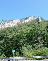
The jagged outline of Seneca Rocks resembles the bony back of a giant dinosaur. This vast mountain of pale stone whose rocks rise 1,000 feet from the forest floor attracts rock climbers. A 1.3-mile trail provides access to the Seneca Rocks overlook, which has spectacular views.
Seneca Caverns opened to the public in 1930 and is one of four commercial caves in West Virginia.
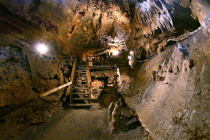
Germany Valley is the most highly developed karst landscape in the Potomac watershed. Schoolhouse Cave and Hellhole Cavern are both located in Germany Valley.
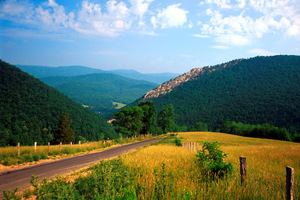
The George Washington National Forest extends for 140 miles through the mountains of western Virginia and eastern West Virginia.
The Monongahela National Forest is the only national forest that is completely within the boundaries of West Virginia.

The South Branch of the Potomac River, with its two major tributaries, the North Fork and South Fork, drains all of Pendleton County and parts of Grant, Hardy, Hampshire, and Morgan counties in West Virginia.
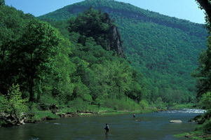
Champe Rocks stand some 900 feet above the valley floor and overlook the narrow river plain near the site where John Champe, a Revolutionary War soldier, possibly lived for a short period of time.
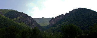
Judy Gap, a notch in standing beds of the hard Tuscarora Sandstone, is a familiar point of reference for hikers, campers, tourists, and others who visit the mountains.
McCoy’s Mill is one of West Virginia’s oldest landmarks. The four-story building was built in 1845, and grain was milled here until the mid-1900s.
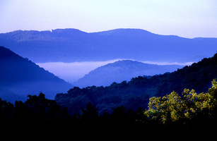
A linear ridge running northeast to southwest in Grant and Pendleton counties, North Fork Mountain extends 34 miles from North Fork Gap to Snowy Mountain (Dry Run) Gap in West Virginia. The mountain is home to Pike Knob Preserve, the location of West Virginia’s only virgin red pine forest. On Panther Knob are a rare dwarf pitch pine woodland and a virgin red spruce forest.
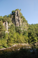
Eagle Rock is named for Revolutionary War veteran William Eagle, who is buried just across the South Branch from the striking landmark.
A ruggedly scenic 18-mile canyon in Pendleton and Grant counties, the Smoke Hole was carved by the South Branch of the Potomac River between North Fork Mountain on the west and Cave Mountain on the east.