 | Back to e-WV
 The West Virginia Encyclopedia
 | Back to e-WV
 The West Virginia Encyclopedia


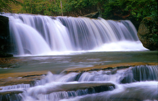
Webster County was created on January 10, 1860, from parts of Braxton, Nicholas, and Randolph counties. Named for Daniel Webster, the county occupies 556.2 square miles and is drained by the Elk, Gauley, Williams, Cranberry, Holly, and Little Kanawha rivers.
Webster Springs, the county seat, was once home to the Webster Springs Hotel, built by U.S. Sen. Johnson N. Camden. The Webster County Woodchopping Festival is held each Memorial Day weekend in Webster Springs.
In the 1890s, a branch of the Baltimore & Ohio Railroad was built to the town of Cowen from Flatwoods.
The earliest white settler in Webster County was most likely Adam Stroud, who settled about 1769 near present Camden-on-Gauley on a tributary of the Gauley River now known as Strouds Creek.
Holly River State Park offers extensive fishing, camping, hiking, and other recreational opportunities.

The Monongahela National Forest is the only national forest that is completely within the boundaries of West Virginia.

The Gauley River rises on Gauley Mountain in western Pocahontas County in West Virginia, and drops nearly 4,000 feet along the 104-mile journey to its juncture with the New River.
The Elk River meanders 177 miles from its headwaters in Pocahontas County westerly to its confluence with the Kanawha River at Charleston.

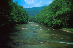
The Williams River rises in Pocahontas County at an elevation of almost 4,000 feet. From its source it flows 33 miles to Cowen, where it enters the Gauley River.
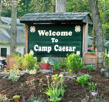
Camp Caesar is Webster County’s 4-H camp. Valued for the beauty of its surroundings and the isolation of its remote location, Camp Caesar has been the site of important state encampments for many decades.

Birch River begins near Cowen and flows in a northwesterly direction for 36.6 miles through Webster, Nicholas, and Braxton counties before entering Elk River at Glendon.