 | Back to e-WV
 The West Virginia Encyclopedia
 | Back to e-WV
 The West Virginia Encyclopedia


Drained by the New, Bluestone, and East rivers, Mercer County has the highest mean elevation of any of the state’s counties. Its most prominent topographic features are the towering edifice of East River Mountain to the south and the Bluestone Gorge to the northeast.
Princeton, the county seat of Mercer County, was named for the Battle of Princeton in New Jersey, where the county’s namesake, Revolutionary Gen. Hugh Mercer, had died. The Battle of Pigeon Roost occurred in Princeton during the Civil War.
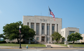
Bluefield, incorporated in 1889, embodied the rapid growth of the southern West Virginia ‘‘smokeless’’ coalfields. It is home to Bluefield State College and the West Virginian Hotel, the tallest building in the state south of Charleston.
Bramwell was once a business center for the Pocahontas Coalfield and a hub of southern West Virginia’s financial network. Many of the coal operators’ homes have been restored and can be toured on special days of the year.


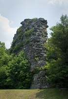
Pinnacle Rock is part of Pinnacle Rock State Park, a seasonal, day-use facility that opened in 1938.
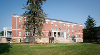
Concord University was established as a state normal school for the training of teachers in 1872.
The last stretch of the Bluestone River, from Wolf Creek to its mouth, occupies the scenic Bluestone Gorge.
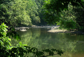
Originating in the valley between Stony Ridge to the northwest and East River Mountain to the southeast, the East River is contained entirely in Mercer County,
Brush Creek Falls is a natural landmark and historic manufacturing site. The spectacular falls, which drop 29 feet, are located in a deep canyon one mile above where Brush Creek flows into the Bluestone River. Jimmy D. Johnson established a water-powered mill at the site about 1880.
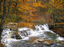
Camp Creek State Park offers a waterfall, campgrounds both rustic and developed, and hiking trails. The park was created from a portion of Camp Creek State Forest in 1987.
Mercer Healing Springs was the site of a successful health and recreational resort in the early years of the 20th century.
The West Virginia Turnpike, the state’s only toll road, runs from Charleston to Princeton.
East River Mountain extends from near Tazewell, Virginia, northeastward for 35 miles to the water gap cut by the New River at the Narrows. In between, the mountain is unbroken by any deep gaps, because of the resistant Tuscarora Sandstone that forms the crest.
